

It can be challenging to identify what Electoral Area or Municipality you live in - especially when you are new to the area! Enter your address to see which North Okanagan community your property is in. The location identified is the same one that administers your property taxes. Electoral Area property taxes are administered by the Province.
Tip: The search works with abbreviations for roadways. For example, Road should be rd, Street should be st, Drive should be dr, and Avenue should be ave.
Community Populations (2021 Census)
| Community | Population |
|---|---|
| City of Armstrong | 5,323 |
| District of Coldstream | 11,171 |
| City of Enderby | 3,028 |
| Village of Lumby | 2,063 |
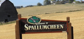
| Township of Spallumcheen | 5,307 |
| City of Vernon | 44,519 |
| Electoral Area B | 3,274 |
| Electoral Area C | 4,511 |
| Electoral Area D | 2,909 |
| Electoral Area E | 1,092 |
| Electoral Area F | 4,362 |